Chicago Tourist Attractions Maps | City Tours Map
Your Complete Guide to the Chicago Tourist Attractions Map
Chicago is a city known for its impressive skyline, lakefront parks, world class museums and historic districts. With major attractions located across the Loop, Millennium Park area, Museum Campus, River North, Navy Pier and Lincoln Park, navigating the city is much easier with a clear tourist attractions map. This guide brings together the most important Chicago tourist attractions in one place, helping you explore architectural highlights, cultural institutions, waterfront viewpoints and iconic neighborhoods efficiently.
The attractions map highlights Chicago's most famous landmarks, including Millennium Park, Cloud Gate (the Bean), Navy Pier, Willis Tower Skydeck, 360 Chicago Observation Deck and the Chicago Riverwalk. These locations provide the classic Chicago experience, and the map shows their exact positions so visitors can plan walking routes through the city’s central districts and lakefront areas.
Chicago's Museum Campus is featured clearly on the map, marking top attractions such as the Field Museum, Shedd Aquarium and the Adler Planetarium. These major cultural institutions sit along the lakeshore, and the map helps visitors understand how to move between pathways, waterfront promenades and nearby transport links without missing key viewpoints.
The map also highlights architectural and cultural districts around the Chicago River, including the Wrigley Building, Tribune Tower, Chicago Theater and popular river cruise departure points. With the city known for its architectural history, the map provides a clear overview of where to find iconic high rises, famous bridges and riverwalk sections.
Nature and outdoor attractions are also included, such as Lincoln Park, Lincoln Park Zoo, Grant Park and lakefront beaches. These areas offer green spaces, walking routes and family friendly activities. The map helps you plan visits that combine park areas with nearby museums, gardens and lake views.
Travelers searching for Chicago attraction tickets will benefit from the map’s clear layout of entrances and ticket points for observation decks, museums, boat tours and paid viewpoints. With this information, visitors can save time, avoid long queues and create smooth sightseeing plans.
Whether you want to explore famous skyscrapers, wander along the waterfront, visit renowned museums or enjoy parks and beaches, the Chicago Tourist Attractions Map gives you a complete overview of the city’s best places to visit. It helps you group nearby landmarks, plan efficient routes and enjoy Chicago at your own pace.
Scroll down to view the full attractions map and begin planning your journey through Chicago’s architecture, lakefront districts and must see highlights.
Frequently Asked Questions About Chicago Tourist Attractions
1. What are the top tourist attractions in Chicago?
Major attractions include Millennium Park, Cloud Gate, Willis Tower Skydeck, Navy Pier, Museum Campus, 360 Chicago and the Chicago Riverwalk.
2. How does the Chicago tourist attractions map help visitors?
The map shows where major landmarks are located across the Loop, lakefront and northern districts. It helps visitors plan walking routes, understand public transit options and organise their sightseeing.
3. Are Chicago attractions walkable?
Many attractions in the Loop and along the Riverwalk are within walking distance. The map highlights pedestrian friendly routes through central Chicago.
4. Do Chicago attractions require tickets?
Several popular sites such as observation decks, museums and some boat tours require tickets. The map helps identify entrances and ticket counters.
5. Which area is best for sightseeing in Chicago?
The Loop is ideal for architecture, the Museum Campus for culture and lake views, and Lincoln Park for green spaces and family attractions. The map shows how these areas connect.
6. How can I plan a one day sightseeing route in Chicago?
A popular route includes Millennium Park, the Riverwalk, Navy Pier and a museum or observation deck. The attractions map helps put these stops in a time saving order.
Top Chicago Attractions Skip-the-line Tickets & Tours
Chicago CityPASS
Go City: Chicago Explorer Pass - Choose 2, 3, 4, 5, 6 or 7 Attractions
Chicago Museum of Contemporary Art: General Admission Ticket
Chicago Walking Tour: Tiffany Treasures
Medieval Torture Museum Ticket with Audio Guide and Ghost Hunting
Chicago by Night: 90 Minute River and Lakefront Cruise
Chicago 3D Fireworks Cruise
Museum of Ice Cream Chicago
Chicago is a big vibrant city that’s known for its house music, jazz, dining, architecture, cultural attractions, and more. Most visitors are impressed with Chicago’s picturesque skyline and the crystal clear water of Lake Michigan. The city is also home to world-class museums, interesting parks, and beautiful sandy beaches.
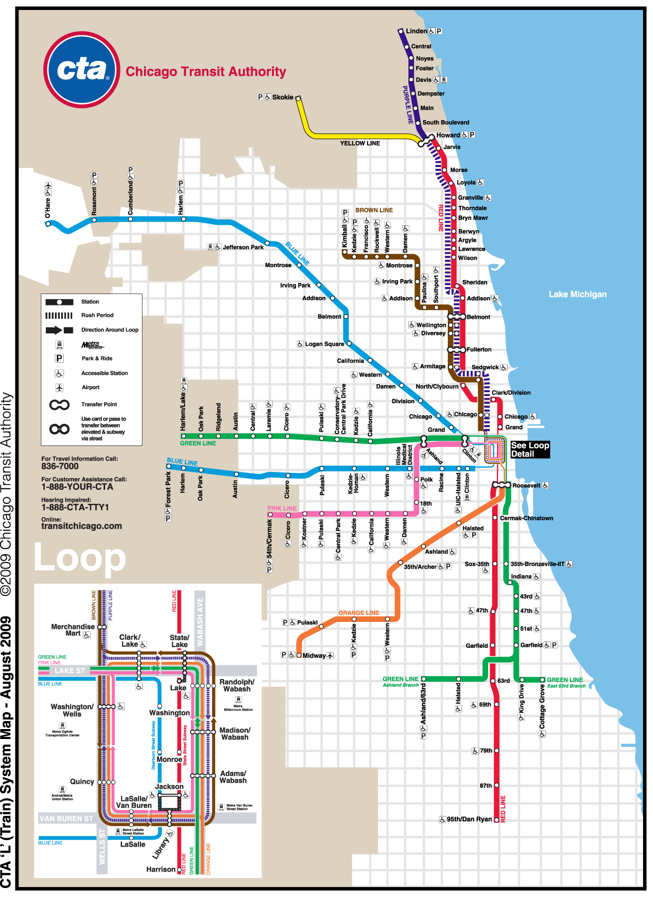
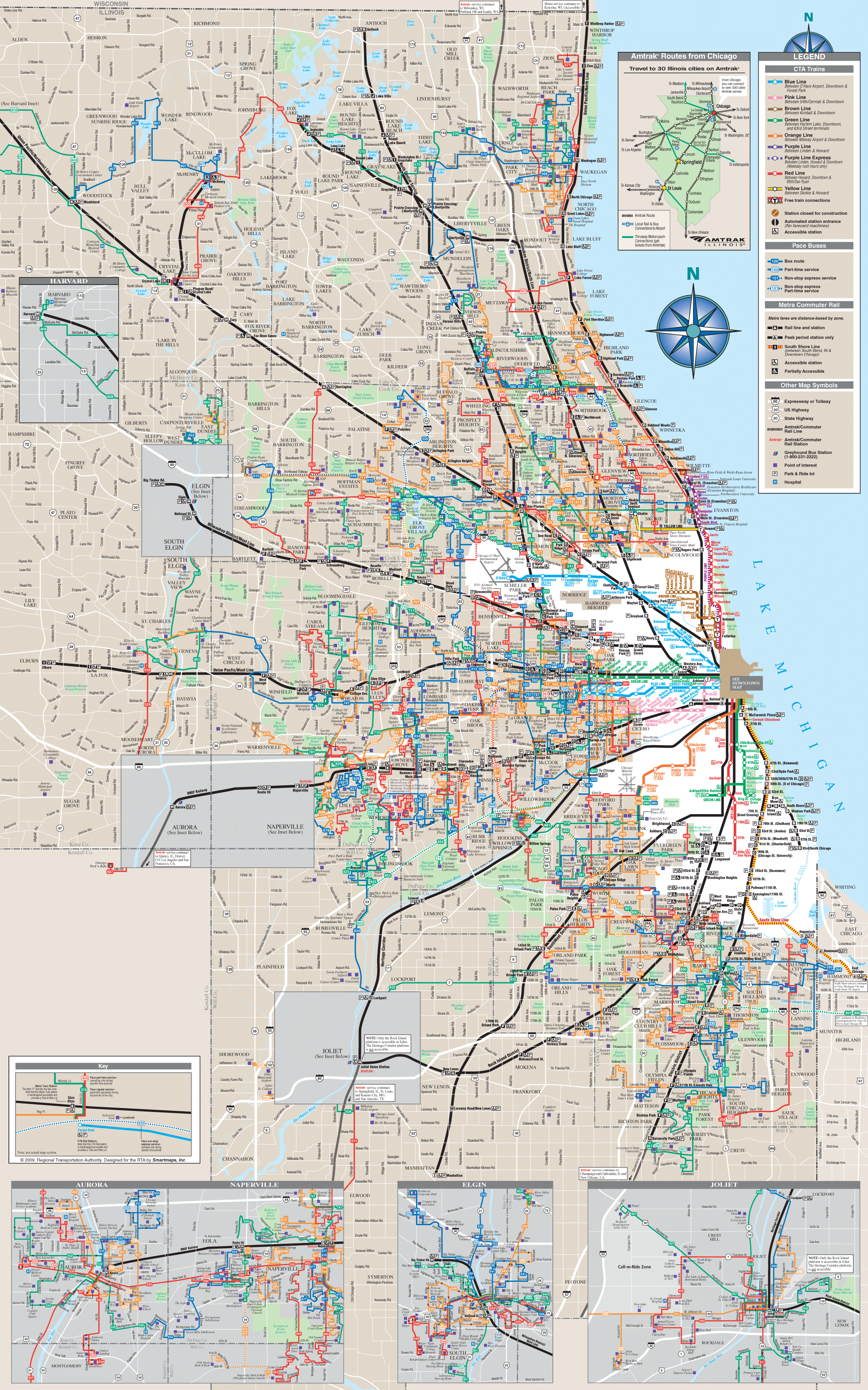
To explore Chicago and discover what this vibrant city can offer, take advantage of its modern public transportation system. We have a free copy of the Chicago metro map that you can use as your guide into exploring the city. With this map, you’ll know which station you need to go, depending on what you wanted to see in Chicago. The Chicago transport map will also provide you with information on what bus you need to take when going around the city.
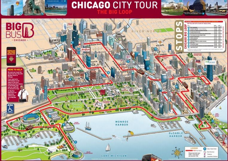
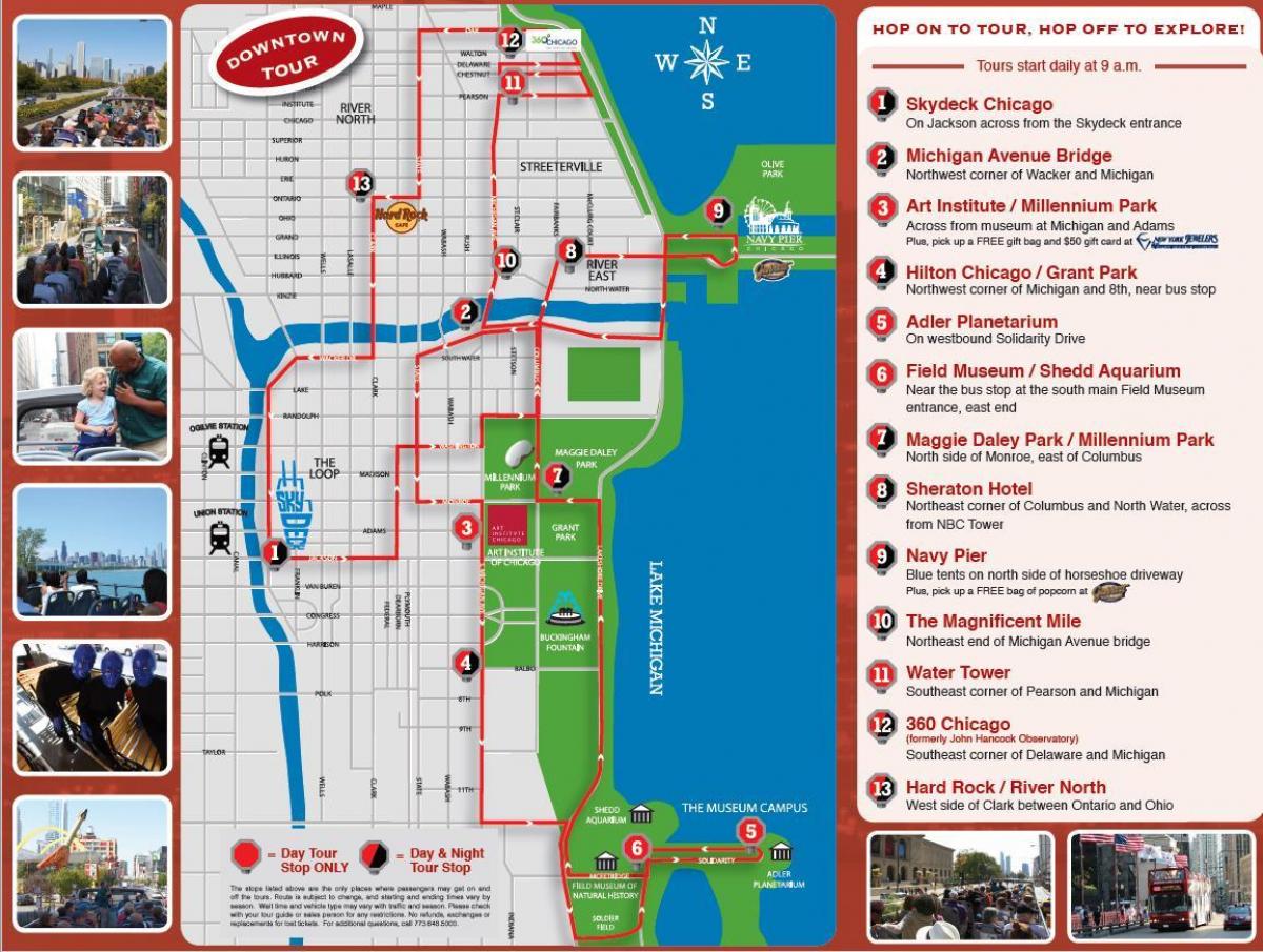
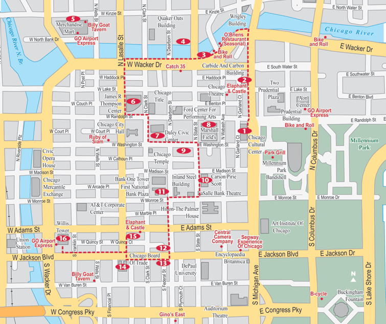
For tourists who wanted to see Chicago’s most popular attractions, the Chicago Tourist Sightseeing Map will be useful for you. This map will tell you how to reach the city’s most famous sights and attractions, that include the Cloud Gate, Millennium Park, Willis Tower, Navy Pier, The Art Institute of Chicago, and John Hancock Center. For those who wanted to see the best museums in the city, this map will also be useful.
It’s also possible to explore Chicago on foot. For as long as you have a copy of the Chicago Walking Tour Maps, you should be able to find your way around the city. There are different walking tours that you can take with the help of these maps. Whether you want to see Chicago’s modern buildings, historical sights, and famous landmarks, these maps will surely come in handy.
For a more convenient way of exploring Chicago, go check out the Hop on Hop off bus tours. To find out where the bus would stop, go get our free printable copy of the ChicagoHop on Hop off Bus map.
Read More See Less